- 6D/5N
- 6D/5N
About the Kedartal Trek:
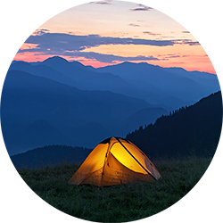
Kedar Tal near Gangotri is the most sought-after destination in Uttarakhand. An enchanting lake situated next to Kedar Bamak Glacier at the foot of the enormous Thalaysagar and Brigupanth Peak. Kedar Tal is one of the most beautiful high altitude lakes in India at a height of 15583 ft. It catches surreal glimpses of the holy site of Gangotri, which goes through the rough trails encircled by fir and bhoj and alpine trees. Tread the hardest trekking routes that lead you to Bhoj Kharak, Kedar Kharak, and Kedartal, relish the utmost beauty possessed by the glacial valleys. The entire Kedar Tal location offers you numerous breathtaking views.
Quick Facts About Kedartal Trek:
Kedartal Trek Duration: 5N/6D
Maximum altitude: 15,583 ft.
Kedartal Trek difficulty: Moderate
Kedartal Trek distance: 38 Kms
Temperature: Day: 12°C to 17°C & Night: -1°C to 3°C
Kedartal Trek Best Time: May, June, September and, October.
ATM: You will find ATMs at Uttarkashi
Start Point/End Point: Gangotri

- 7D/6N
- 7D/6N
About Kashmir Great Lakes Trek:
Cuddled up cosily amidst the mountains, Kashmir Great Lakes Trek is yet another hidden jewel of Kashmir as it validates Kashmir’s mythical status as heaven on earth. The beautiful Alpine and snow-clad mountains will walk through the paths, and green meadows, and rocky terrains are there to bound the journey.
Every day is a 360° panorama of wild, rugged mountains, rolling meadows and turquoise alpine lakes and you get more than seven of these lakes and five very different valleys to explore! The Kashmir Great Lakes, however, is an IMAX 3D experience – such is the grandeur of the trek. If you have not done this trek, put it on your bucket list!
Kashmir Great Lakes Trek Quick Facts:
Duration: 7D/6N
Trekking distance: 72km
Maximum Altitude: 13,800ft
Difficulty Level: Moderate
Kashmir Great Lakes TrekTemperature: 17°C-20°C (Max. During Day Time) to 3°C-4°C ( Min. During Night Time)
Best Time to do Kashmir Great Lake Treks: July to September
Railway Station: Jammu is the nearest railway station
Airport: Srinagar Airport
Start Point: Sonmarg
End Point: Naranag

- 7D/6N
- Srinagar
- 7D/6N
About the Tarsar Marsar Trek:
Kashmir the “paradise on earth” and universally proclaimed as the home to the most spectacular treks in the Himalayas. Tarsar Marsar Trek takes the cake among all of them. Perched on the cloud-piercing altitude of 13,201 ft, The Tarsar Marsar Trek is composed of majestic trails and three alpine lakes- Tarsar, Marsar, and Sundarsar that complements the beauty of each other.
As you trek through these pristine lakes, you will be amazed by the lush green meadows of Kashmir. Embraced by the thick avenues of splendid Chinar tree forest and the spellbinding Lidder river, which is also known as a glacier river flowing through the Kolahoi Glacier. Throughout the whole day during the stay, you will be stunned by variable shades of snow-fed lake changing with the angle of the sun.
Tarsar Marsar Trek Quick Facts:
Duration: 7D/6N
Maximum Altitude: 13,201 ft
Tarsar Marsar Trekking Difficulty level: Moderate
Tarsar Marsar Trek Distance: 47kms
Temperature Range: During the day: 17°C - 20°C and During the night 3°C - to -4°C
Best Time for Tarsar Marsar Trek: July - September
Railway station: Jammu is the nearest station [ 260kms ]
Airport: Srinagar
Basecamp: Aru (112 km drive from Srinagar approx 4 hours)
Atm: Pahalgam [ But do not rely on the last ATM as it runs out of cash frequently. Withdraw cash at Srinagar or even before that.]
Start point / End Point: ARU

- 5D/4N
- 5D/4N
About Hampta Pass Trekking
A person who loves to be in the lap of nature it is the time to trek in the dreamland of unpredictable terrains of Hampta Pass. Landscapes change vividly every few hours of walking on the Hampta Pass trekking trail. The lack of any treacherousness in the trail is compensated by the abundance of natural beauty, which will take you by surprise at every twist and turn of the trek. The entire trail of the Hampta Pass trek is dotted with everything you can dream of witnessing on a trek.
What makes the dramatic changes heightened, even more, is how thrilling the climb to Hampta Pass is. For trekkers, crossing the Hampta Pass is a great story of adventure. You will love the nervous excitement of climbing to the pass over many ledges.
Quick facts about Hampta Pass Trekking:
Start Point/End Point: Manali Base Camp
Duration: 4 Nights & 5 Days
Hampta Pass Trek Height: 14,100ft
Hampta Pass Trek Difficulty Level: Moderate
Trekking Distance: 35kms
Best time to do Hampta Pass Trek: Mid June - September

- 8D/7N
- 8D/7N
About the Roopkund Trek:
The "mystery Lake of Uttarakhand" - the Roopkund Lake - is a must-do trek for an avid trekker. The Roopkund trek is a moderate trek, with a beautiful view of mountainous rivers, enthralling ridges, lush forests, and scenic meadows around. The trek starts from Lohajung and takes you through a high altitude of 16,499 ft., during which you can spot Bedni Bugyal, the quaint villages of Wan and Didna. The zig-zag and snowy trail offers the best views of the Roopkund lake, Neelganga river, and also offers a memorable experience of meditating at the Kalu Vinayak temple.
Do not forget to notice the royal twin peaks of Nanda Devi, Kamet, Dronagiri, and Hathi- Ghodi Parvat and spot the rare-yellow Himalayan magpie.

- 6D/5N
- 6D/5N
About the Kuari Pass Trek:
With a visit to popular pilgrim cities such as Rishikesh, Devprayag, Joshimath, and Haridwar, the Kuari pass trek, situated in Garhwal Himalaya is a 33 KM long journey. The trek is famous for letting you onlook India’s second-highest peak, Mount Nanda Devi.
The trek at an altitude of 12,516 ft. also offers you summit views of Dronagiri, Chitrakantha, Chaukhamba, and Tali top. The Interlude of meadows, beautiful forests blooming with rhododendron, and oak trees make your path all the more scenic. While on the trek, you can also admire the mesmerizing views of holy rivers such as Bhagirathi and Alakananda which makes the ascent even more exciting.
Kuari Pass Trek Quick Facts:
Duration:6D/5N
Kuari Pass Trek Distance: 33 km
Kuari Pass Altitude: 12,516 ft
Difficulty Level: Easy To Moderate
Kuari PassTemperature: Day: 13°C to 18°C and Night: -3°C to 4°C
Best time for Kuari Pass Trek: March till mid-June & mid-September to early November
Railway Station: Haridwar is the nearest railway station
Airport: Jolly Grant Airport, Dehradun
ATM: Last ATM is available in Joshimath
Start -End Point: Haridwar

- 7D/6N
- 7D/6N
About The Trek:
Nestled cozily on the hinges of the Gharwal Himalayas, Har ki dun trek is one of the most popular treks among a lot of trekkers and nature enthusiasts. This exhilarating trek is also known as a hanging valley because of its cradle-shaped mountains.
It is also known as the winter-wonderland as in winter the trails are totally covered with snow and the sun throw its rays within the clouds. The Har ki Dun trekking is embraced with soothing sights of deodar trees that will definitely enchant your soul with the pine smell.
Har Ki Doon Trek Quick facts:
Duration: 7D/6N
Maximum altitude: 11,675 ft
Har Ki Dun Trek Difficulty Level: Easy to Moderate
Har Ki Dun Trek Distance: 47 KM
Temperature: 10℃ to 15℃ during the day and 2℃ to -5℃ during the night
Best Time to do Har ki Dun Trek: April to Mid-June and October to Mid-November
ATM: Purola has the last ATM before your trek begins
Start/End Point of the trek: Sankri Village

- 10D/9N
- 10D/9N
About GoechaLa Pass Trek:
GoechaLa trek is nestled at a height of 16,207 ft, with a closer look at the third-highest peak-Mt. Kanchenjunga. It is a dream and desire for hundreds of adventure lovers. Bounded by the mesmerizing flora and fauna, which are so vibrant and colourful to cheer up one's mood.
The GoechaLa pass trek is a bundle of big summits, making it an absolute adventure to embark on. The trail link with the famous Kanchenjunga National Park, where one can witness the true nature, enough to revitalize your senses. To watch the mountains clearly, April and May are the ideal months. Since the sky is completely clear during this time and the sunset-sunrise views can be captured.
GoechaLa Pass Trek Quick Facts:
GoechaLa Trek duration: 10D/9N
Maximum Altitude: 16207 ft
Difficulty Level: Difficult
GoechaLa Trek Distance: 90 Km
Temperature Range: April - June: 15 to 22 Degrees (Days); -1 to 7 Degrees (Nights), September – Nov: 10 to 15 Degrees (Days); -5 to 5 Degrees (Nights)
GoechaLa Trek Best Time: April end - May And September - November
Railway Station: New Jalpaiguri (NJP) is the nearest railway station, which is 150 km away from Yuksom
Airport: Bagdogra Airport which is 155 km from Yuksom
ATM: Yuksom is the last point where you can find the ATM.
Starting and Ending point: Yuksom

- 4D/3N
- 4D/3N
About the trek:
Perched at a towering height of 14,245 ft above sea level, the spectacular Indrahar Pass lies at the border between breathtaking Kangra and Chamba districts. Though a short one, this trek is considered to be a bit challenging as the trekking trail consists of numerous sharp ascents and steep climbs. This is one of the most fascinating treks that Himachal has to offer. Owing to the magnificent view of the might Dhauladhar, the lush green valleys, and the exotic flora and fauna will truly leave you awestruck. The path passes by the placid crystal blue waters of Lake Mankiani and Kareri. Hike through the steep passing mostly through the lush green landscapes of the Dhauladhar Range, this challenging yet tempting trek takes about 4 days to complete.
Start Point/End Point: Mcleodganj - Bhagsu Nag Taxi Stand.
Inclusions:
- Stay: Domed tents on sharing basis cleaned & sanitized on daily basis
- Meals: Breakfast, Lunch and Dinner
- Activities: Trekking & Camping
- Highly experienced trek guide

- 5D/4N
- 5D/4N
About Sar Pass Trek:
Perched at 13,800 ft. above sea level, Sar Pass offers the magnificence of a beautiful verdant landscape and is a heaven for photographers, artists, and nature lovers. Set against a curtain of majestic Himalayan peaks wrapped in snow, the Sar Pass trek passes through some of the most scenic views ranging from forests to the meadows to the ice blankets.
While trekking across the path from Tila Lotni to Biskeri Ridge, one has to pass by a small, usually frozen lake which means "Sar" in the local language of Himachal. Hence the name, Sar Pass! The trail passes through the thick forest and takes you to a winter wonderland that makes it fascinating.
Sar Pass Trek Quick Facts:
Start Point/End Point: Kasol Base Camp. (It is 2 km away from the Kasol Bus Stand)
Duration: 4N/5D
Maximum altitude: 13,800 ft.
Sar Pass Trek Distance: 48 Kms
Temperature: 22°C (Max. During Day Time) to -5°C ( Min. During Night Time)
Best Time for Sar Pass Trek: April to October.

- 7D/6N
- 7D/6N
About Pangarchulla Peak Trek:
Adorning the Lord Curzon circuit- one of Garhwal Himalaya’s most fabled trails, Pangarchulla Peak Trek. The peak is usually covered with snow and rugged mountain terrains. The one dominant characteristic of your winter adventure to the Pangarchulla Peak will be the treat of snow.
The paves are swaddled with alluring lush greenery, dense jungles, and pristine snow-capped landscapes around. A close-up look of the Garhwal region can be discovered through this trek with the sunshine falling on its summit. Travelers choose to head out on this Trek just to behold the remarkable sights of Nanda Devi, Mana, Hathi, Lampak, Dronagiri.
Pangarchulla Peak Trek Quick Facts:
Duration: 6D/5N
Maximum Altitude: 15,069 ft.
Pangarchulla Peak Trek Difficulty Level: Moderate to Difficult
Trekking distance: 38 km
Temperature: Day 18°C to 12°C & Night -3°C to -6°C
Pangarchulla Peak Trek Best Time: April, May, October, November
Start point/Endpoint: Joshimath
ATM: Joshimath
Railway Station: Haridwar
Airport: Jolly Grant Airport, Dehradun