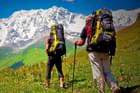
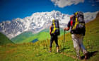
Winter Treks in Himalayas
Himalayas Winter Treks Packages | Duration | Price |
|---|---|---|
| Kedarkantha Trek, Uttarakhand | 5 days & 4 nights | USD 64.25 |
| Brahmatal Trek, Uttarakhand | 6 days & 5 nights | USD 75.91 |
| Kuari Pass Trek from Joshimath | 6 days & 5 nights | USD 93.33 |
| Har Ki Dun Trek, Uttarakhand | 7 days & 6 nights | USD 115.64 |
| Pangarchula Peak Trek with Kuari Pass | 7 days & 6 nights | USD 108.05 |
| Kasol Camping with Chalal and Kheerganga Trek | 3 days & 2 nights | USD 70.07 |
| Chopta Chandrashila Trek from Delhi | 3 days & 2 nights | USD 72.42 |
| Bhrigu Lake Trek, Manali | 4 days & 3 nights | USD 70.07 |
| Kareri Lake Trek, Mcleodganj | 3 days & 2 nights | USD 32.7 |
| Beas Kund Trek, Manali | 4 days & 3 nights | USD 56.06 |
| Indrahar Pass Trek, Mcleodganj | 4 days & 3 nights | USD 75.91 |
| Sandakphu Trek | 6 days & 5 nights | USD 108.05 |
Kedarkantha Trek, Chadar Trek, Everest Base Camp Trek, Har Ki Dun Trek, Hampta Pass Trek, Laka Glacier Trek, Goechala Trek, Kasol Kheerganga Trek, Nag Tibba Trek, Beas Kund Trek and many more.
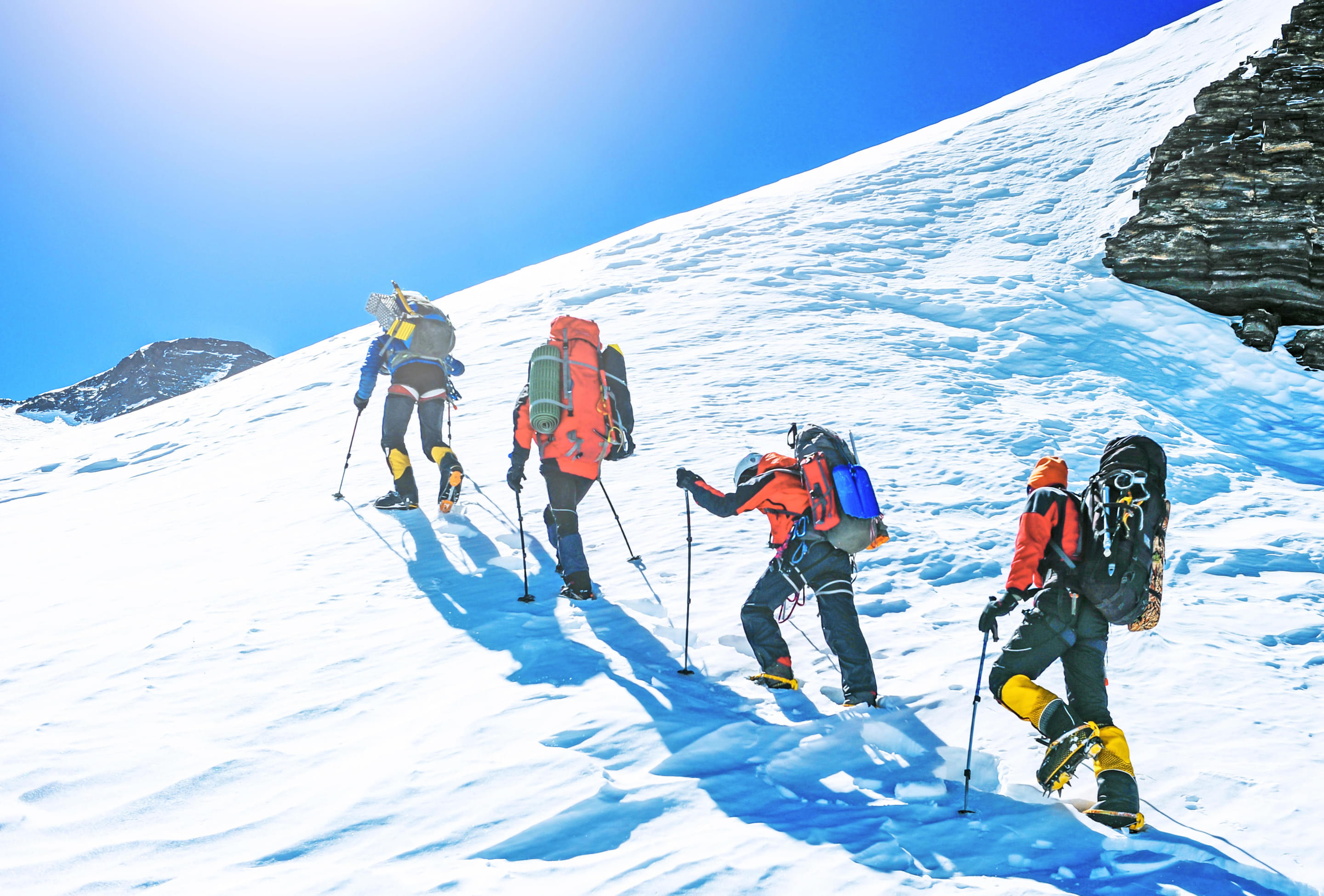
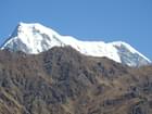
Thrillophilia organises some of the best winter treks in the Himalayas to help you have the thrilling adventure of a lifetime. During the winter, we offer various snow-trekking options, such as the Everest Base Camp Trek and Kasol Kheerganga Trek. Whether you’re an experienced trekker or a beginner you’ll find a winter Himalayan trek that will suit your skill level.
Enjoy the breathtaking views of the Himalayan peaks as you undertake the Kedarkantha Trek and walk over the frozen Zanskar River by opting for the Chadar Trek. Discover the Garhwal Himalayas’s untouched beauty by embarking on the Har Ki Dun Trek and enjoy unadulterated views of nature as you traverse through Hampta Pass Trek. Laka Glacier is one of the best winter treks in the Himalayas for intermediates and beginners and offers majestic views of the snow-covered mountains.
For those looking to have a moderate-level trekking experience, the Nag Tibba Trek, Kasol Kheerganga Trek, and Beas Kund Trek are the best choices. Check your physical fitness and carry proper gear while undertaking these Himalayan winter treks to have a safe journey. Embark on a memorable trekking expedition and appreciate the beauty of the Himalayas by giving Thrillophilia a chance to arrange your trekking expedition.
Himalayas Winter Treks Packages


.jpeg?w=340&dpr=2)


Kuari Pass Trek from Joshimath
.jpg?w=340&dpr=2)


Har Ki Dun Trek, Uttarakhand


Chopta Chandrashila Trek from Delhi
.jpg?w=340&dpr=2)


Bhrigu Lake Trek, Manali


.jpg?w=340&dpr=2)
.jpg?w=140)
Kareri Lake Trek, Mcleodganj


.jpg?w=340&dpr=2)
Beas Kund Trek, Manali

.jpg?w=340&dpr=2)


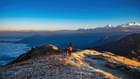
Best Winter Treks Destinations


.jpg?w=1280&dpr=1)

Our Partners
Newly Added Experiences
Tourism Board Alliances
Himalayas Winter Treks FAQs
What is the best time to go trekking in the Himalayas?
March to May (Spring) is the best time to undertake winter trek tours in Himalayas as the weather is mild and the trekking routes are full of rhododendrons. September to November (Autumn) is also ideal for trekking in the Himalayas as the skies are clear, temperatures are mild and the trails are dotted with colourful foliage.
Which is the best winter trek in the Himalayas?
Everest Base Camp Trek, Kedarnath Trek, Chadar Trek, and Hampta Pass Trek are some of the best winter treks in the Himalayas. These expeditions give you a chance to walk on ice amidst the panoramic landscapes. Enjoy the views of frozen waterfalls, rare flora and fauna, and lush green meadows as you undertake these treks.
What is the average temperature in the Himalayas in winter?
The average temperature in the Himalayas in winter ranges around 8 degrees celsius to -30 degrees celsius. In higher altitude treks like Chadar Trek or Everest Base Camp, the temperature can go down at night below freezing. In lower altitude regions, the temperature ranges from around 5 to 18 degrees Celsius.
What are the best Snow treks in the Himalayas?
Here are some of the best Snow treks in Himalayas:
1. Chadar Trek: Chadar Trek is one of the best winter treks in Himalayas , giving you a chance to walk over the frozen Zanskar River. The frozen waterfalls, remote villages, and snow-capped mountains create a breathtaking backdrop for trekking.
2. Triund Trek: Your winter trek tours in Himalayas won’t be complete if you don’t visit Triund Trek which is renowned for its natural beauty and snow-covered landscapes. The trek traverses through the lush green forests of Rhododendron and Oak, leading you to the magical views of the Dhauladhar range.
3. Everest Base Camp Trek: Everest Base Camp Trek is known to be one of the best winter treks in Himalayas , giving you an opportunity to capture the magnificence of Everest. By undertaking this trek you’ll get to experience the local Sherpa culture and conquer Kalapathar's summit.
4. Nag Tibba Trek: Nag Tibba Trek takes you on an enthralling journey to Nag Devta’s sacred abode. Explore the beautiful valleys, and remote villages and encounter the cultural traditions of the locals as you head to the Nag Tibba base camp.
Is it safe to trek in the Himalayas during Winter?
Yes, it is safe to trek in the Himalayas during winter if you’re well-prepared and acclimatise yourself to the high altitude and chilly weather. Choose the right trekking route and ensure that you’re physically fit for the physical demands of trekking in harsh conditions. You can join guided winter treks in Himalayas for a safe experience.
Which is the best winter trek for beginners in the Himalayas?
Dayara Bugyal Trek, Brahmatal Trek, and Beas Kund Trek are the best winter treks in Himalayas. They are ideal for beginners as they have well-marked trails and are easy to access. These treks do not require extensive technical skills due to their manageable terrains and offer scintillating views of the frozen lakes and alpine meadows.
Which is the most difficult trek to do in winter in the Himalayas?
Chadar Trek is one of the most challenging and best winter treks in Himalayas that can only be undertaken by experienced trekkers. During this challenging expedition, you have to walk through the completely frozen Zanskar Lake, cross icy patches, and tolerate extremely cold temperatures.
How do we prepare ourselves before trekking in the winter?
If you’re trekking in winter choose the trek carefully ensuring it aligns with your skill level. Build stamina by engaging in physical exercise and acclimate yourself to high altitudes. Buy good quality trekking gear and research the weather conditions before going on the trekking expedition.
What are the things I should carry for trekking?
1. An easy-to-carry daypack to store essential items.
2. Snacks like fruits, nuts, and energy bars to keep yourself energised.
3. A sturdy sleeping bag and tent.
4. First aid kit and high altitude sickness medicine.
5. Ankle-length waterproof boot.
6. A wind-cheater, fleece jacket, pants, waterproof outer jackets, a pair of comfortable pants, thermal underwear, a few scarves, warm socks, and regular underwear.
7. A reusable water bottle, sunglasses, sunscreen, moisturiser, and lip balm.
8. Insect repellant, band-aids, gauze, camera with extra batteries.
What type of shoes are required for trekking in the Himalayas?
High-ankle shoes with a good grip are ideal for winter treks in the Himalayas as they provide stability while traversing the rugged terrains. If you are trekking during snowy weather or rainy season, a properly insulated waterproof trekking shoe should be your perfect choice to keep your feet warm.
What are the most popular monsoon treks in the Himalayas?
Here are some of the best Monsoon Treks in Himalayas:
1. Kashmir Great Lakes: Kashmir Great Lakes should definitely be undertaken during your winter trek tours in Himalayas as you’re treated to lush green landscapes and stunning alpine meadows. In the monsoon, you can see eight Alpine lakes as you transverse through the rugged trails.
2. Tarsar Marsar Trek: In monsoon, the scenic beauty of the Tarsar Marsar Trek is at its peak leading to a rewarding trekking experience. As you undertake the trek you can enjoy surreal views of alpine lakes, lush green valleys, and towering peaks.
3. Hampta Pass Trek: During monsoon, Hampta Pass comes alive with lush greenery and you can see blooming flowers everywhere. The waterfalls and rivers look captivating due to the heavy rainfall creating a splendid backdrop for trekkers.
4. Valley of Flowers Trek: Valley of Flowers is one of the most popular monsoon treks as the entire valley gets covered with vibrant flowers and greenery. You can see the flowers changing colours every week from pink to yellow and red during monsoon.
What are the most popular weekend treks in the Himalayas?
Here are some of the best Weekend treks in Himalayas:
1. Kareri Lake trek: Kareri Lake trek is located in the Dhauladhar range and can be covered in around 2 days. As you undertake this trek you’ll witness pristine alpine lakes and majestic peaks. There are various campsites along the trail where you can have a short stay.
2. Chandrakhani Pass Trek: Chandrakhani Pass Trek is situated at an altitude of 12,030 ft and offers breathtaking views of the Dhauladhar ranges and Pir Panjal. The trekking distance is around 17 kilometres and can be covered in 3 days.
3. Nag Tibba Trek: Nag Tibba is one of the best Himalayan winter treks that takes you through lush green forests and offers mesmerising views of Bandarpunch Peak. You will need 2 days to undertake the complete trek.
4. Triund Trek: Triund Trek is one of the most popular Himalayan winter treks that can be completed in 1 to 2 days. As you reach the Triund hilltop you can soak in the splendid views of the Kangra Valley and Dhauladhar range.
What are the best selling short treks in Himachal?
Himalayas Winter Treks Reviews